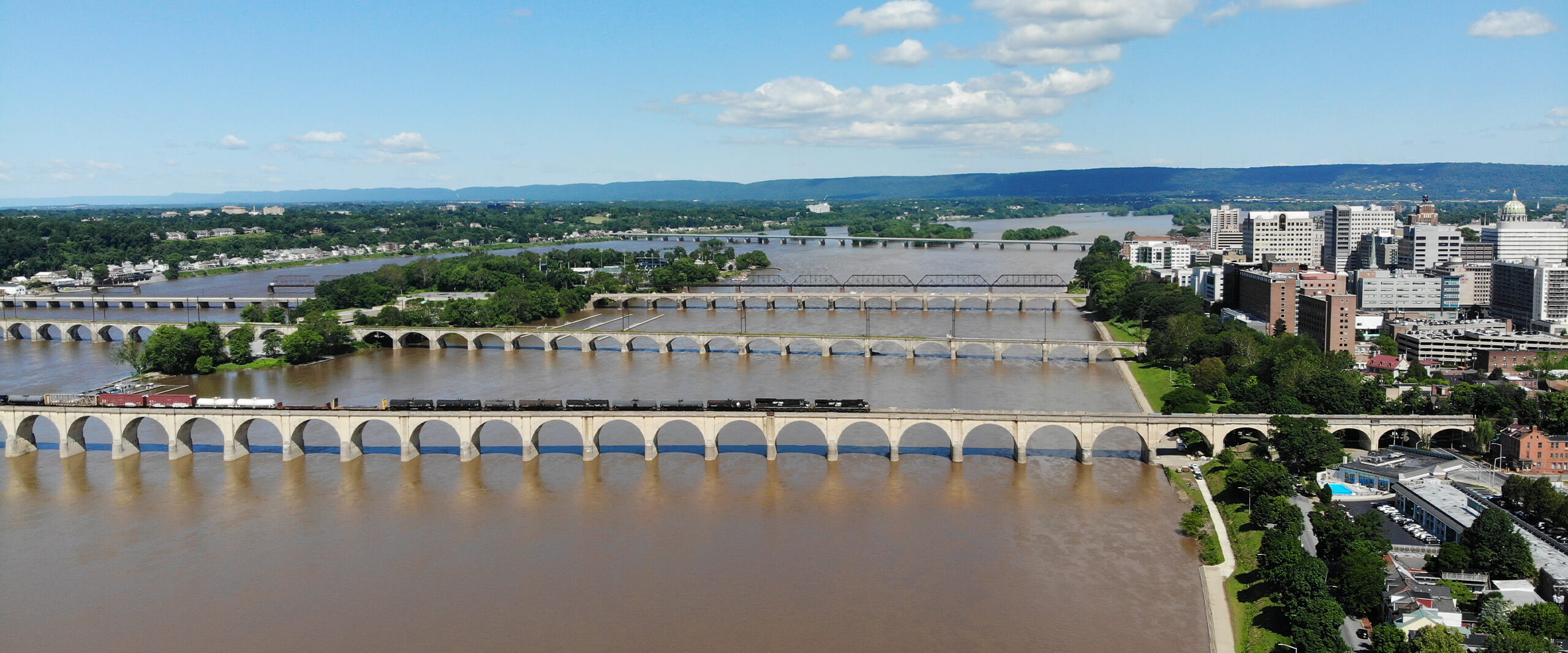
On the east shore of the mile-wide Susquehanna River, Harrisburg, Pennsylvania, serves as the state’s capital and is rich in history, commerce, and industry. The John Harris, Market Street, M. Harvey Taylor, George Wade and Clarks Ferry bridges carry major roadways that span the river, intertwining as alternate routes to one another. In addition to serving residential and commuter traffic, several of the bridges are also part of the Federal Highway Administration’s Primary Highway Freight System and can average more than 40,000 large trucks every day. With such a high degree of commerce consistently passing through the region, the five crossings are critical for the Pennsylvania Department of Transportation (PennDOT) to accommodate more than 250,000 commuters, residents, and interstate business deliveries daily.
A playbook to address maintenance and replacement options for each of the bridges moving forward was necessary to detail plans for construction, preservation, vehicle capacity, multi-modal, and funding needs for each bridge in the coming decades, as well as to identify short-term strategies for traffic mitigation in the event of planned and unplanned events ranging from construction, rush hours, and minor crashes to significant flooding events or incidents. As the report would be referenced by a variety of audiences, it needed to be comprehensive, dynamic, and easily updated over time. In spring 2019, KCI was contracted to research these many layered considerations and create a master plan to serve as a guide for years to come.
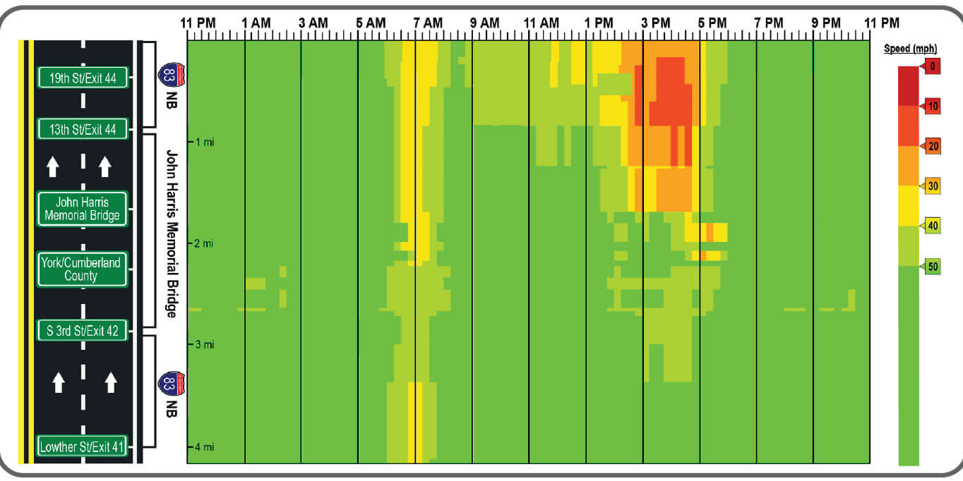 Our team worked to compile findings for multiple traffic and structural components from a variety of sources to address existing and future issues and challenges.
With no formal plan in place to account for traffic impacts due to lane closures on the bridges, our team compiled and analyzed data from an array of local and regional sources. Utilizing software and third-party tools, engineers identified common origin and destination points in the region, high volume rush hour times, reasons for congestion, current and expected future traffic conditions, and options for mitigating backups on the highways. Anticipating driver trends was key to planning maintenance of traffic for emergency situations that could arise and led to strategic improvement suggestions along adjacent roadways.
Environmental resources for each bridge were evaluated using GIS-based online repositories maintained by federal and state agencies. Based on these reviews, our team accounted for land usage and water quality designations, recreational trails, endangered species, waste sites, water routes, and community facilities in the area. Local features were then mapped out to inform project managers on the absence or presence of resources and scope out the necessary level of environmental documentation needed to move forward with improvements for each bridge.
As the five study area bridges also serve more than 700 pedestrians daily, ancillary projects that could assist in facilitating multimodal flow were included in plans to move commuters elsewhere in the event of a bridge closure. Bicycle and pedestrian needs were considered, and safety upgrades were suggested, including wayfinding signage, curb extensions, bike lanes, and improved sidewalks.
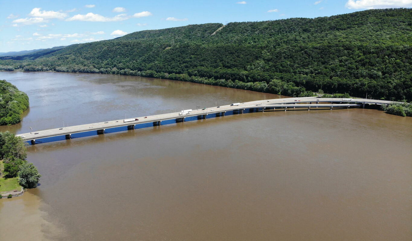 The Clarks Ferry bridge hosts the Appalachian State Trail and allows pedestrians to cross the river on foot.
Our team led the structural analysis efforts by looking extensively into historic and existing conditions and other significant projects completed over the lifespan of each bridge. After reviewing all previously available reports on the five subject bridges, engineers utilized historical data for more than 40 additional Susquehanna River crossings with similar material, climate, and traffic needs to effectively create a deterioration model and predict when rehabilitation or replacement of bridge components would become necessary in the future.
“With a variety of audiences referencing the data, our team ensured the end result led to a more comprehensive report than typical master plans.”
– Robert Nuss, PE, PTOE, Highway & Traffic Practice Leader
Rehabilitation and replacement projects, particularly on structures as large as the Susquehanna River bridges, are often very costly and require advance financial planning. With a variety of ever-changing circumstantial factors, it had also been difficult to create contingency plans for partial shutdowns necessitated by phased construction projects on the structures.
KCI established each bridge’s future needs in isolation before mapping out a strategy to address combined needs without overlapping construction timelines. From this evaluation, a future maintenance, rehabilitation, and replacement schedule, including strategic companion projects to help facilitate network-wide traffic flow, was developed as a complementary tool for the client to plan upcoming projects. A master plan summary document was also created and shared publicly to promote transparent planning practices in the capital region.
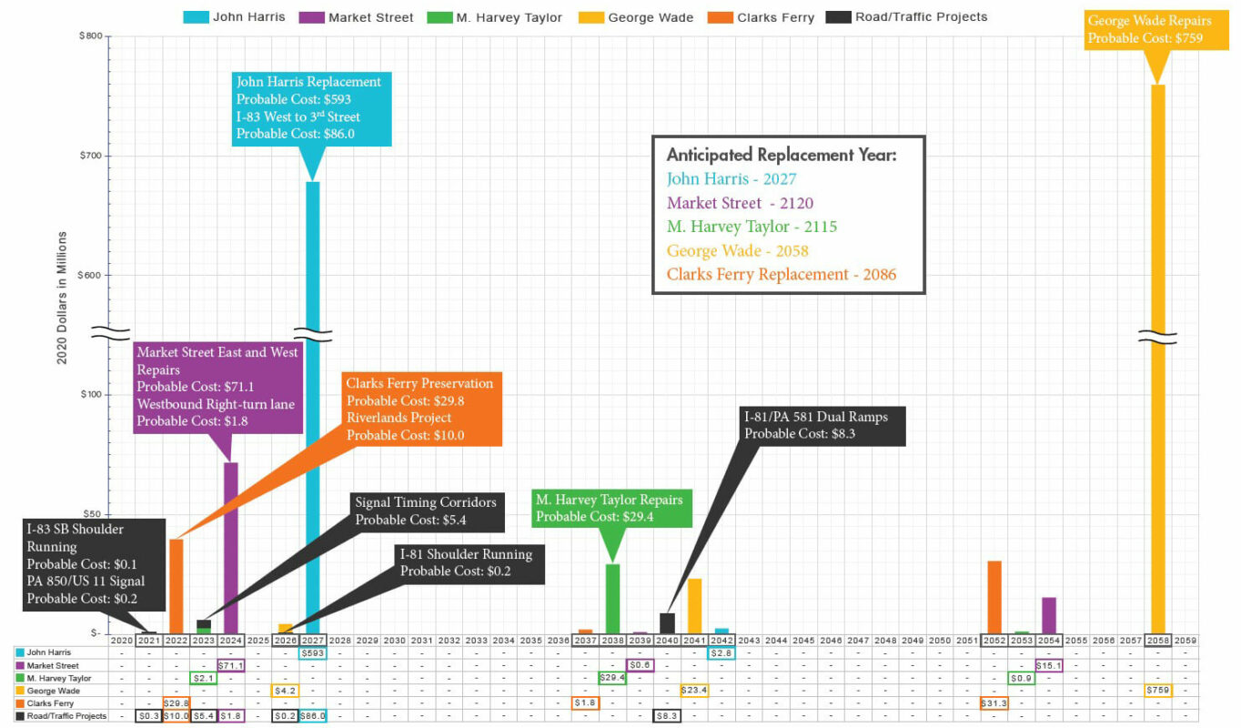 Repairs and new construction timelines were mapped out with estimated costs, ensuring that each bridge could be addressed without overlapping schedules and multiple simultaneous crossing closures.
As future bridge construction would impact several stakeholders throughout the region, our team collaborated with numerous public and private entities to ensure that everyone who could be potentially affected was considered. KCI performed extensive outreach by meeting with regional planners, first responders, local governments, railroad companies, and utility companies to assess their individual needs and identify a host of potential concerns.
“KCI performed an excellent job in developing this River Bridge Master Plan, which is a vital tool for our Department’s current and future large river crossing planning needs in this region.”
– Douglas Knoll, PE, Pennsylvania Department of Transportation
To create a document that effectively and coherently blended traffic, structural, environmental, and financial components together, KCI gathered massive amounts of data from numerous sources, evaluated them, and consolidated the results into a comprehensive yet easy-to-understand final product. Engineers referenced studies from a wide breadth of sources, ensuring that results were consistent with previous reports and went in depth on desired outcomes.
A constant line of communication with the Pennsylvania Department of Transportation was maintained throughout the process to ensure client buy-in and accomplish all assigned goals for the document, which was finalized under budget and ahead of schedule. Relying on the completed master plan, future generations of engineers and planners will be able to assess conditions and devise solutions, allowing commutes, lifestyles, and commerce to continue seamlessly in the Harrisburg region for decades to come.