
As geospatial and mapping environments have continually increased in complexity, more and more municipalities are struggling to manage these environments with internal resources.
Deploying ArcGIS Enterprise to the cloud can provide a host of benefits, but migration from on-premise systems can be challenging. KCI assisted Anne Arundel County’s Office of Information Technology (OIT) in taking their GIS system online through Amazon Web Services with an ArcGIS cloud implementation. Our team worked to bridge the knowledge and communication gaps between municipal GIS staff and third-party cloud-managed hosting provider ROK Technologies.
“GIS systems have become more complex over time. It’s critical during cloud migrations that municipalities have access to staff that can work across all aspects of the technology—platform, data and network infrastructure—to ensure success.”
– Ian Botts, Solutions Architect
The county has been moving away from maintaining data and servers on-premises. The cloud provides a better solution in terms of budget, maintenance, security and reliability. Scalability is also a substantial benefit but with an additional cost. “Their existing GIS systems were very static,” said KCI Solutions Architect Ian Botts. “Updates were provided quarterly to OIT, which would post the data.” The county had also been experiencing significant outages during both planned and unplanned maintenance activities.
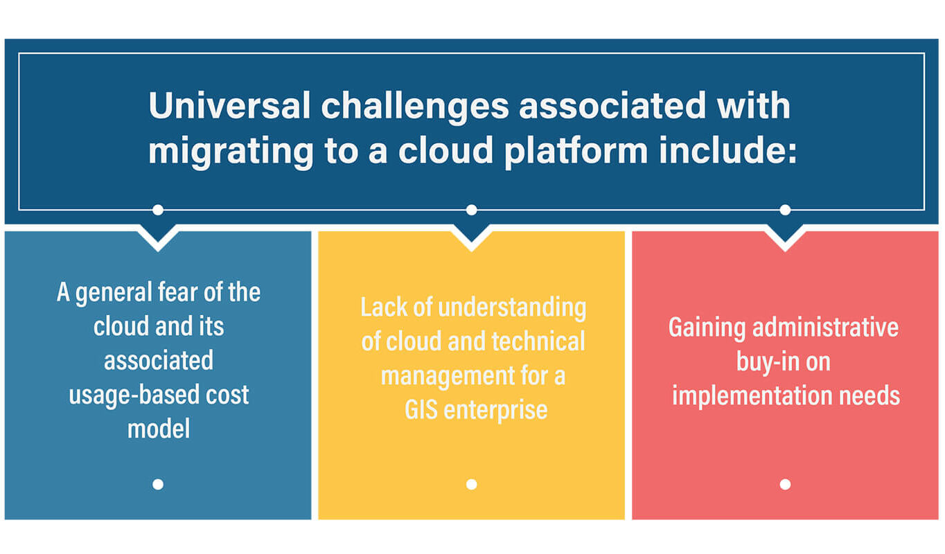
“At the local government level, staff and resource constraints can cause systems and management approaches to fall behind the IT curve,” said Anne Arundel County GIS Manager Dave Gillum. “ESRI has moved ahead even faster than the normal pace of IT evolution, and enterprise managers must live and breathe the system to understand the complexity.”
GIS managers had contracted with ROK Technologies to manage the system migration and host the data. Thanks to the firm’s long-term relationship supporting the county, KCI was asked to serve as an intermediary and advocate for the implementation.
“OIT needed the perfect combination of GIS and IT expertise and perspective,” said Vice President and Regional Practice Leader Heidi Hammel, GISP, PMP, ITIL. “Our team has served in this type of role for other municipalities, and Ian was both familiar with their systems and had the needed experience to facilitate the migration.”
Botts has helped both small and large organizations adopt best practices, meet industry standards and implement strategic initiatives that require a more holistic knowledge of the IT and GIS landscape. “Regardless of how much documentation there is in standard operating procedures and workflow diagrams, at least 60 percent of operations is in an individual’s mind,” said Gillum, noting that it can take up to six months to bring a new person up to speed. “Ian is constantly expanding his knowledge base, both within the county’s system and globally, and then feeds that back into our enterprise.”
As a liaison, Botts works with both county and ROK staff to document existing infrastructure, develop the complex information architecture, address unexpected challenges and promote the vision to internal stakeholders and users.
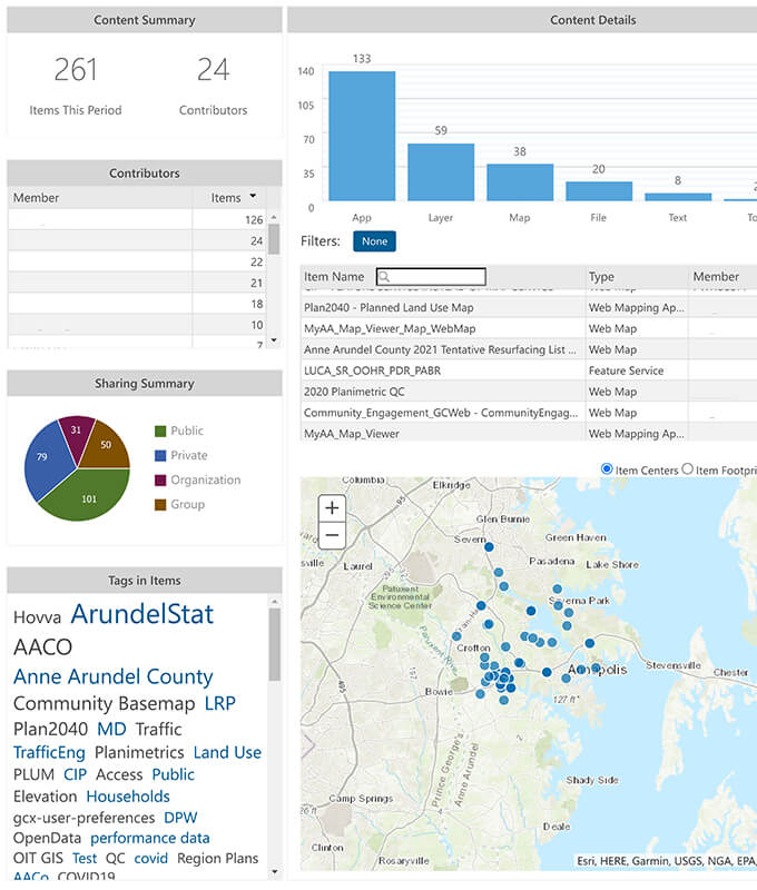 Real-time dashboards provide metrics that help the county, KCI and ROK monitor performance, identify potential issues and address concerns within the could enterprise platform.
An ArcGIS cloud implementation offers a more collaborative environment. “Their GIS platforms had been decentralized for a long time,” said Botts. “This migration gave them the opportunity to get all users working on the same framework for the first time.” Staff can create their own datasets and applications instead of relying on a centralized GIS department. The system is also more nimble and can quickly stand up new applications and upgrades.
Through this ArcGIS cloud implementation, the county is building a foundation to support other enterprise applications. “Their new permit and asset management systems are 100 percent GIS-centric, which means a greater reliance on the GIS infrastructure and a larger user base,” said Hammel. “The cloud is a more scalable and reliable platform to support their enterprise systems and will provide a greater peace of mind to county GIS managers.”
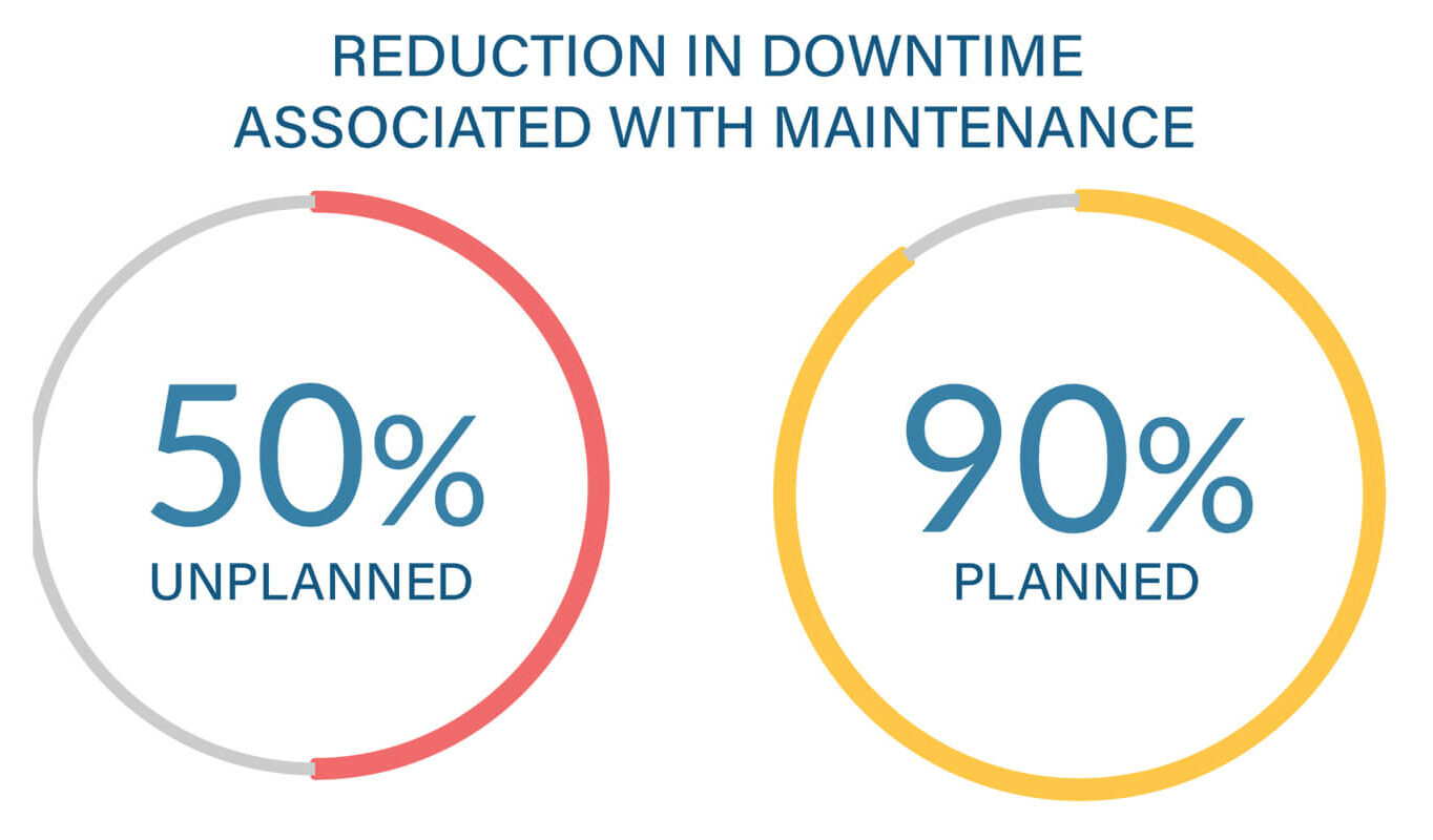 Prior to launch, the county would experience frequent system outages. Moving to the cloud has significantly reduced downtime.
Once live, the county quickly amassed more than 800 users—100 data creators and 700 viewers. The system also began generating an immediate return on investment as the OIT was able to easily deploy new Esri web applications in response to the COVID-19 pandemic. “One of the best decisions I’ve made in my career is going to the cloud,” said Gillum. “The county is now moving additional servers based on our success.”